Downtown, Maine: Greater Bridgton
A travel series by Elizabeth Peavey
In today’s climate of global warming and sky-high gas prices, the idea of a joy ride may be going the way of, well, the horse and buggy. Problem is—whether you’re a geezer out for a Sunday cruise and early-bird special, a greaser circling your town square on a Saturday night with an Old Milwaukee wedged between your thighs, or simply an urbanite who just wants to get away from her neighbors and smell a little country air—driving around in cars is fun.
And there’s really no better reason to take to the open road (aside from evading the law) than autumn in Maine. The tourista traffic has begun to abate, there are leafs to be peeped and back roads to be explored. Seasons can pass the city-dweller by if she’s not careful. So trade off some carbon credits and come with me.
As you will recall from last time, when I took you to Brunswick, I set down some pretty specific rules for car travel in Maine. Among them: a DeLorme’s Gazetteer is mandatory equipment. It’s not just because you are likely to get lost on the convoluted route I’m about set out for you; it’s that in order to enjoy the full aesthetic experience of a drive, you need to have a lay of the land, understand where you are and what you’re looking at. You need to know if you’re driving by some natural wonder like, say, Hogfat Hill or Brownfield Bog, that you shouldn’t miss. Plus, the Gazetteer’s size and laminated cover make it a great lap tray when eating something messy, or a handy surface while painting your toenails. (Please don’t follow my bad example and attempt this while driving. Remember, I’m a trained professional.)
Ready then? Let’s begin.
Atlas in hand, find Route 25 out of Portland (hint: Brighton Avenue) and make your way to Gorham and The Gorham Grind. This friendly coffee house has comfy chairs and quiet tables, and serves up Coffee By Design coffee and light breakfast fare. Grab a cup and a treat, find a seat, and turn to Map 4. Map 4 is contiguous to Map 5, which is home to Portland, meaning—like last time – I’m not going to drag you too far away from the state’s urban center. Of course, there are numerous “superstar” foliage trails I could point you to—into the North Woods, through the western mountains, or way Down East—but as promised, I’m keeping this close to home.
So, on Map 4, let’s sketch out a rough perimeter, starting at Route 25 and East Limington (E-4—that’s map talk). From there, trace down Route 11 to Limerick, up 160 through Porter, South Hiram, East Brownfield and Denmark (where 160 mysteriously disappears and becomes 117), northeast on 117 to 302, and northwest (oh, yes, you might also want to have a compass on hand) into Bridgton. Then follow 107/11 south back to North Limington, where 11 meets 25 again, just west of East Limington. This is a route, but this is not our route. This is our perimeter. Feel free to use this as a route, but if you do, you’re going to have to get your own tour guide. We’re just setting boundaries.
You are, at this point, probably a little nervous, not sure where I’m taking you. Hiram? Limington? Denmark? These aren’t even towns most of us have heard of, let alone had a desire to visit. That’s OK. As well as I know the state, this area was a mystery to me for years—too close to Portland to merit exploring, too distant to be where anyone I knew would live. It’s not Sebago Lake, it’s not the western foothills, it’s just an unknown place on the map fairly close to home. If it makes you feel any better, though, you may refer to it as West of Portland, or WoPo.
WoPo. Sort of sounds a little like a suburb, doesn’t it? Sort of smacks of sprawl. That’s why, besides stopping for coffee in Gorham and maybe taking a detour to Randall Orchards, our tour does not officially begin until the other side of sprawlish Standish. There, on your right, you’ll find the Standish House of Pizza.
I have a special place in my heart for this grinder palace. Many years ago, when Portland was still Portland, there was a grinder palace on the corner of High and Congress streets called Alpha Delta House of Pizza. There, a young arts editor of an alternative weekly could assuage her urban angst with the best tuna melty on earth (it’s all about the shredded lettuce). The palace, yes, was a little tired—the paint could’ve used freshening and the Athenian prints needed some updating—but the Greek owners (known to me only as Mr. and Mrs. Alpha Delta House of Pizza) were lovely. When they decided to close shop, I was devastated. But, lo, some years hence, I was traveling out this route, stopped into the Standish House of Pizza and found the Alpha Delta House of Pizza had only migrated. Better yet, there was the return of my beloved tuna melty!
Well, I have to confess: my last one was not quite up to snuff (someone got a little slap-happy with the mayo), so I can’t without reservation say this is the best grinder palace on earth. But if I’m willing to take a chance again—which I absolutely will—so should you.
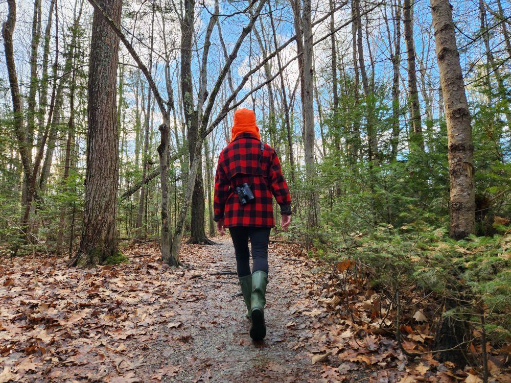
I am now going to suggest a small detour. You cannot come out to WoPo in the fall and not get out of the car. Thus, I am going to give you several options for hikes, and this first one, Douglas Mountain, is the easiest. Just outside of Standish, bear right at the fork at the junction of Route 113, follow 113 north through Steep Falls into East Baldwin (don’t these towns sound like something out of The Waltons?), jump on 11 north and merge left onto 107 shortly thereafter. Take Dyke Mountain Road, then Douglas Mountain Tower Road (this is a lot easier than it sounds; just look at your map) to the parking area. A swift 15-to-30-minute hike will take you to the top of this 1,000-foot hill, and the stone tower that crowns it, for a panorama that includes both the White Mountains and the Atlantic coast, as well as a heapin’ helpin’ of fall color.
A word of caution: remember that whole sprawl thing? Well, that comes with people. Douglas Mountain has been “discovered,” and you are likely to have to share the trail at peak peep times. Of course, if you are ill-at-ease in nature, you might prefer the presence of others. It’s a comfort to know someone will hear your screams as you tumble off a hill. (Kidding.)

Back on Route 25, traveling west from our fork-off point, you will soon come to the Limington Falls rest area, better known as The Rips. This is a great spot for a picnic—there are tables, yes, but it’s better to grab a slab of former magma (the geology is amazing here) and watch the water wend by. If it’s still early in the season and warm, a dip might be in order, but you need to know a couple things. First, the current is swift, the rocks are slippery, and unless you securely anchor yourself, you might find yourself (and your tuna melty) careering off boulder after boulder, carried downstream. The other thing is, people bring their kids here and pump them full of juice and soda. If you wade in, I suggest doing so as far upstream as possible.
For the sake of our tour, we are going to proceed into Cornish on Route 25, but I can tell you that following 11 south through Limington and Limerick will give you stunning hill-and-dale views. There really are no bad roads out here, so I’m not going to force you to stay with us, but don’t come crying to me if you get lost.
We are going to spend some time in Cornish, but not yet. Pass through town and take a left onto Route 5, south to Limerick. This is one of the few stretches of smooth, flat roadway you’ll find out here, but its gentle curves give way to a lumpen landscape of rolling hills and forests spiked with plenty of hardwoods. This route will also give you a glimpse of the real Maine: lots of double- and singlewides, crap out in the yard, junked cars—what the literati giggle and call The Beans of Egypt, Maine-Maine. I, however, find these stretches both desolate and comforting. It’s nice to know some things about this state will not change.
A tunnel of trees leads you into the sweet little town of Limerick, perched in the hills above Sokokis Lake. Have a stroll around town and try to finish a rhyme for “There once was a lady from Sokokis … ,” or take a razor-sharp right at the hairpin turn at the Free Baptist Church onto 160. This road will lead you through cornfields, hayfields, apple orchards, and roly-poly hills, and curves into East Parsonsfield, where you will continue to gain elevation to Dearborn Mountain. From there, you will overlook a bowl of hills, Long and West ponds below you, and pass old graveyards and stone walls. In North Parsonsfield, check out the grand old barns, beautifully restored farmhouses, Parsonsfield Seminary and Parsonsfield Consolidated School, located on a straight-out-of-Ethan Frome village green. A quick jog will take you into Porter, where there’s an 1876 covered bridge with decidedly 21st-century graffiti, and hook you back up with Route 25.
By now, you’re surely ready for a break, so head east on 25 back into Cornish and get out of that car. With its recently renovated “downtown,” Cornish is all classic New England village: shady town green surrounded by a wrought-iron fence, new old-fashioned streetlamps, inviting benches, a bubbling fountain, new sidewalks and faux-brick crosswalks. If you’re ready to revive yourself, stop by Krista’s Restaurant, housed in a former antiques shop perched over a babbling brook. Airy and open, with lots of hardwood and good smells, this is a great stop for a latte, a beer, or a full meal. They serve breakfast, lunch and dinner, and strive to stick to that fresh-and-local tenet. There are salads and sandwiches, as well as such offerings as “special hunk of beef,” “sweet chili yummlets” (fried flour tortilla with spicy dipping sauce), and Thai mussels.
 A poke around town will reveal numerous antiques shops—some of them tony, like the multi-floored and multi-stalled Cornish Trading Company; some not-so. One real place of interest is The Smith Company—part junk shop, part Smithsonian—located in a former 1920s service station. (Children, that is what we called the places where we bought gas in the olden days, when your gas actually was pumped for you.) There’s a lot of what might be termed “architectural salvage” (read: things we used to take to the dump in the olden days, but now a lot of people pay a lot of money for) and other curios from yesteryear. Proprietor Steven Smith’s roots in the area go way back, so if you have any questions about Cornish, don’t ask me. Ask him.
You must save time for a visit to Apple Acres Farm, which is located just north of town on Durgintown Road (take Bridge Street off 25 to get to this road, and follow the sign). In addition to their beautiful local apples, their retail store features Maine-made treats, including the most delicious homemade donuts ever. One of these donuts, accompanied by a snappy apple cider, could bring the most jaded foodie to tears.
To the west of Cornish, a trip up Towles Hill Road will take you to Highland Farms, famed for their Jersey cows, and a blazing fall panorama. You can also detour north on Route 5 to Hiram Falls, a sandy local swimming hole, where the townies hang out. (Read: “townie hangout” often means broken glass and charred Old Milwaukee cans in the fire pit; we’ve had mixed results on visits there.) If you want a bit more quiet, Hiram Nature Study Area is right across the way, or you can forge on to climb Mount Cutler. This is great hike—especially when there is snow on New Hampshire’s Presidential Mountain Range—but finding the trailhead and the trail itself is a little tricky. My best advice is to consult a guide—either in print or on the Web (there are many sources)—cross reference, and then ask a local for backup. I could give you directions here, but they might lead you astray (I’ve had trouble finding it both times I hiked here), and I don’t want that kind of responsibility.
Ditto all that for the Burnt Meadow Mountain Trail, located on Route 160 north of South Hiram, where we’re headed next. This route is another scenic stretch, a road fringed by sandy shoulders and scrub pine, with lots of shimmering ponds below. Continue on 160 through Brownfield and East Brownfield—that is, unless you have concert tickets at Carol Noonan’s cathedral-like, timber-frame Stone Mountain Arts Center in Brownfield, which features both national and regional acts in a very country-cozy setting. If you press on, don’t be shocked when all the bucolic splendor is shattered by the parking lot Route 160 turns into as it crosses the Saco River. The traffic—both road and water— is much worse at the height of summer, when the sides of the road are lined with cars bearing Massachusetts and New Hampshire plates, and the river is bobbing with drinkers and floaters and waders. You’ll pass by campgrounds that use such terms as “wilderness” and “sanctuary” in their names. And you will keep on going.
Don’t forget that in Denmark, Route 160 turns into 117, which merges with 302 and takes you into our ultimate destination, Bridgton, which by this point will seem like a thriving metropolis.
That is, if you get there before 5 p.m.
Bridgton has somehow managed to avoid most of the strip-mall mess and congestion its neighbors to the south around Sebago Lake—Naples, Raymond, North Windham—have experienced. There’s a real, walkable downtown here, with lots of handsome Victorian buildings and frontier-looking facades, and a nice park. You get the sense that people actually live and shop and work here.
When we arrived late on a Saturday afternoon, however, the Reny’s—which is putting on a huge addition—was already closed, as were many of the other stores and shops. We did find Bridgton Books, a large and cheery independent bookseller, still open, and had a nice browse and a chat with the woman behind the counter.
(OK, here comes another travel tip: When you arrive in a new town and want the skinny on the place, always stop by a bar or a book store—the former is best for dining insights; the latter for town gossip. Never make inquiries at shops that have unicorns in the window or sell art glass.)
I asked her about the Magic Lantern movie theater—a small art-house theater with a Victorian lobby that was demolished a couple years back because, as she put it, the building was “basically sliding into the river.” The good news is that construction of a new Magic Lantern is underway, with plans for it to reopen later in the fall with three screens, one (hopefully) still dedicated to indie films.

You might be losing steam by now. If you need a bit of refreshment, The Black Horse Tavern has been serving up good grub and grog in an equestrian atmosphere for 20 years. Or you might choose to wait and have a craft-brewed pint and snack at Bray’s Brew Pub in Naples on your way home.
I am sending you back the quick way, on Route 302. You’ve done enough driving and used up too many carbon credits for one day. After all this, you’re going to have to take the Portland Metro for a month.